FREE SHIPPING - $99 or more, restrictions apply. Excludes any Long or Oversized items
Cart
No products found...
Home Port Charts
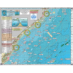
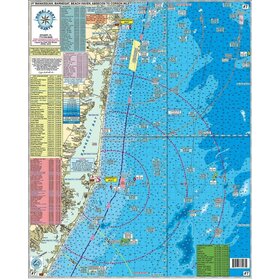
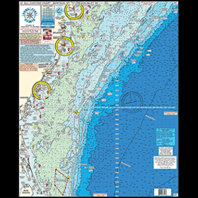
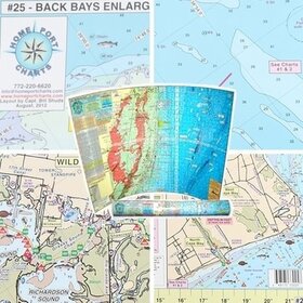
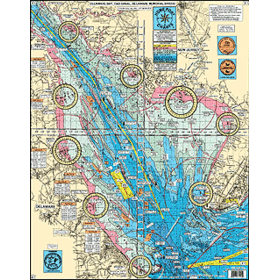
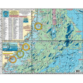
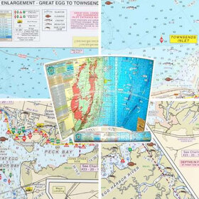
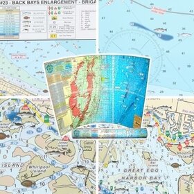
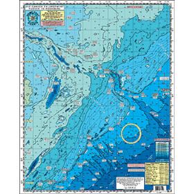
Home Port Charts offer the most comprehensive fishing and diving charts available on the market. Covering the waters of the East Coast from New York to North Carolina and Central Florida to the Keys and Bahamas, Home Port Charts show you more information than any chart plotter can.
Showing 1 - 9 of 9
More filters
Home Port Chart #7 Wreck/Reef Manasquan to Corson's Inlet
In stock
#7 Manasquan, Barnegat, Beach Haven, Absecon to Corsons Inlet Near shore - out 15 plus miles.
Home Port Chart #12 Hudson to Poorman's Canyon
In stock
#12 CANYON CHART ENLARGEMENT. Hudson Canyon to the South Poorman's
Home Port Chart #1 Delaware Bay, C&D Canal to Delaware Memorial Bridge
Out of stock
#1 Delaware Bay to the C&D Canal to the Delaware Memorial Bridge. Entire Delaware Bay with an enlargement of the" RIPS"
Home Port Chart #10 "Tuna Chart" Barnegat, NJ to Ocean City, MD
In stock
#10 "TUNA CHART' Barnegat, NJ to Ocean City, MD. ALL GPS
Home Port Chart #24 Back Bays Enlargement GE to Townsends Inlet
In stock
Back Bays Enlargement - Great Egg to Townsends Inlet
Home Port Chart #23 Back Bays Enlargement Brigatine to GE Inlet
In stock
Back Bays Enlargement - Brigantine to Great Egg Inlet
Home Port Chart #2 Wreck/Reef Little Egg to Indian River Inlet
Out of stock
#2 INSHORE BEACH HAVEN TO CAPE MAY, NJ TO BETHANY BEACH, DE
Home Port Chart #3 All Canyons Chart
Out of stock
#3 GPS ALL Canyons Chart. Montauk Point, NY to Oregon Inlet, NC
Home Port Chart #25 Back Bays Enlargement Townsends Inlet to Cape May Inlet
Out of stock
Back Bay Enlargement - Townsends Inlet to Cape May Inlet